The Frontier in 1776
In this week’s blog post we’re going to step back in time 250 years to visit each of our Bob’s Market locations, but first, let’s get our bearings at perhaps one of the most populated and recognizable areas at the time, a grimy frontier fort that smells of rotting fish in the summer sun, and is alive with traders bringing in furs, tobacco, and other goods from further up the Ohio and Kanawha Rivers.
Point Pleasant, Virginia
In 1776, Point Pleasant (then part of Virginia, now West Virginia) was a remote, militarized frontier outpost at the confluence of the Ohio and Kanawha Rivers, not yet a formal town but a strategic military and settlement site.
The area had recently seen major conflict in the Battle of Point Pleasant on October 10, 1774 (part of Lord Dunmore's War), where Virginia militia under Colonel Andrew Lewis defeated Shawnee and Mingo warriors led by Chief Cornstalk. This victory helped open the region south of the Ohio River to colonial settlement by weakening Native resistance and leading to a treaty ceding claims to much of present-day West Virginia and Kentucky.
Key Events and Military Presence in 1776
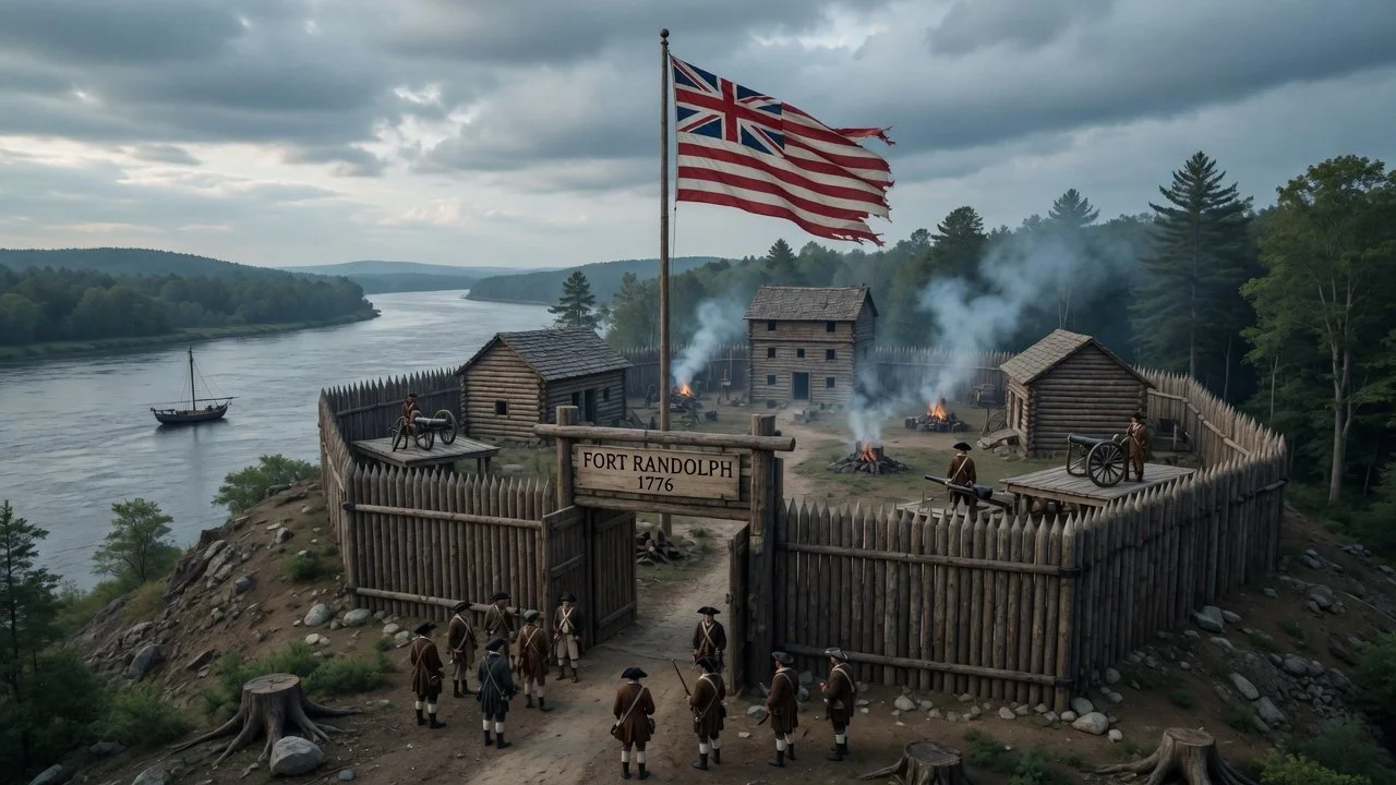
Fort Randolph sat at the site of the current Tu-Endie-Wei State Park.
Fort Randolph was constructed in May 1776 by Captain Matthew Arbuckle and Virginia militiamen sent from Fort Pitt (Pittsburgh). It replaced the earlier Fort Blair (built after the 1774 battle and later damaged/burned). The new fort was a stockade with blockhouses and cabins, named after Peyton Randolph (first president of the Continental Congress). It served as a key defensive outpost on the western frontier during the early American Revolutionary War.
Garrisoned by about 100 men at full strength, it protected against potential British-allied Native American raids and helped secure the "back door" of Virginia. It was part of broader efforts to prevent Native alliances with the British.
The site was still raw and dangerous. Earlier Fort Blair had been evacuated in 1775, and tensions remained high. (In 1777, Chief Cornstalk was killed at the fort while seeking peace, leading to retaliation and a siege in 1778 that the garrison repelled.)
Settlement and Daily Life
Permanent European-American settlement was just beginning. There were likely a small number of settlers, traders, and military families around the fort, but no large civilian population yet. The town wasn't officially chartered until 1794.
Life was typical of the trans-Appalachian frontier:
Harsh and precarious — focused on survival, defense, hunting, basic farming (corn, etc.), and river-based trade/transport.
People lived in or near log cabins/stockades for protection from raids.
The rivers provided vital transportation routes but also exposure to threats.
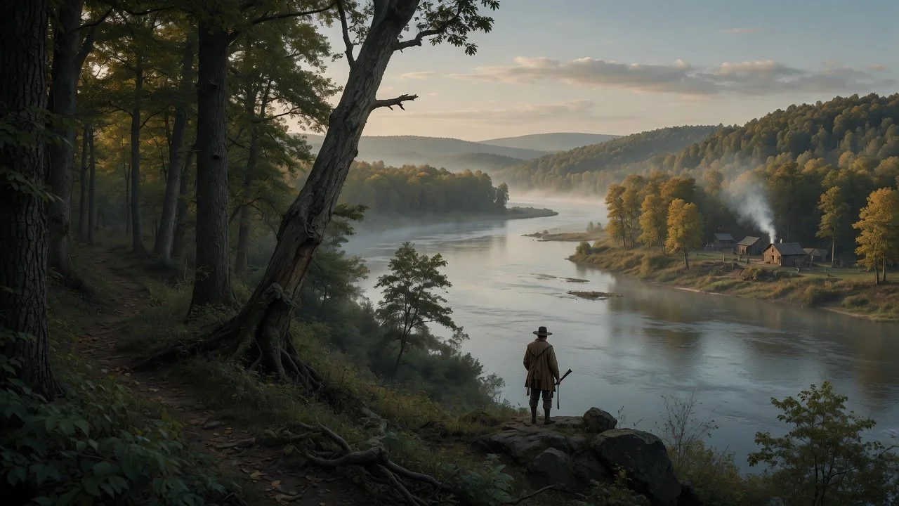
George Washington had camped there in 1770 while surveying, reportedly calling it a "pleasant point."
Broader context: This was during the lead-up to and early stages of the Revolutionary War (declared in 1776). The area was a buffer zone, with militia activity tied to both Indian wars and the fight against Britain.
Overall, 1776 in Point Pleasant was a time of transition from wartime camp/battleground to emerging fortified settlement. It was rugged, sparsely populated, and militarily focused rather than a bustling community. Today, the area honors this history with Tu-Endie-Wei State Park (battle monument), a replica of Fort Randolph in Krodel Park, and museums.
Gallipolis, Northwest Territory
In 1776, the site of what would become Gallipolis, Ohio (in present-day Gallia County), was undeveloped wilderness along the Ohio River — no European settlement existed there yet.
The area was part of the broader Ohio Country (Northwest Territory after the Revolution), a contested frontier region primarily used by Native American tribes, especially the Shawnee, along with occasional hunting, trading, or raiding parties from other groups like the Mingo or Delaware. It was not a major village site but lay within Shawnee-influenced territory in the central Ohio River Valley.
No permanent European presence: Permanent European-American settlement in the immediate area began much later. Gallipolis ("City of the Gauls") was founded in 1790 by the "French 500" — a group of French immigrants (aristocrats, merchants, artisans) who arrived via the Scioto Company land speculation scheme. They were fleeing the French Revolution and arrived to find crude log cabins built for them in what is now City Park.
Mason, Virginia
Washington's "Lost Colony": George Washington had surveyed and claimed large tracts in the Kanawha River area (including ~10,990 acres on the south side). In 1775, he sent agents (James Cleveland and William Stevens) with colonists to clear land, plant orchards, and build houses on these grants (bounty lands for French & Indian War service). Some activity occurred near Beech Hill and other riverbottom areas in present Mason County. However, the Revolutionary War disrupted it; the colony was largely abandoned by war's end, with settlers leaving or the effort failing due to raids, supply issues, and conflict. This is commemorated today as Washington's "Lost Colony."
Waggener Connection: The future Mason site (Waggener's Bottom) was linked to land associated with Andrew Waggener (or similar spelling), one of Washington's surveyed grantees/officers. Early attempts at settlement were tentative and not sustained in 1776.
Belpre, Northwest Territory

The area was unsettled frontier wilderness in the vast Northwest Territory known for its natural beauty rather than any permanent European or American presence.
French Influence and Naming: French trappers and explorers had passed through earlier and named the scenic river valley "Belle Prairie" (or "Belle Pré"), meaning "beautiful meadow" or "beautiful prairie," due to its fertile alluvial bottoms, meadows, and river views along the Ohio River. This name later shortened to Belpre when Americans arrived.
Native American Presence: The broader Ohio Country was home to various Indigenous groups, including Algonquian-speaking peoples like the Shawnee, and others such as the Delaware (Lenape), Wyandot, and remnants influenced by earlier conflicts (e.g., Beaver Wars). The region saw shifting control and was not densely populated in that exact spot but was used for hunting, travel, and resources.
Colonial/European Status: Following the French and Indian War (ended 1763), Britain claimed the area, but it remained largely Indian territory with limited European settlement due to the Proclamation of 1763 (restricting colonial expansion west of the Appalachians). The American Revolutionary War was underway in 1776, but fighting in the Ohio Country was minimal at that exact time—mostly later involvement with tribes allying with the British or Americans.
The land itself featured rich river bottom soils, forests (oak, hickory, etc.), bluffs, springs, and wildlife—ideal for future farming, which is why it was chosen later.
1788: As part of the Ohio Company of Associates (post-Revolutionary War land grants to veterans), pioneers from New England (many Revolutionary War officers) explored and began settling nearby Marietta.
1789: Belpre (the second permanent settlement in Ohio) was established just downriver from Marietta. Settlers built log cabins, cleared forests for farms, and faced challenges like Indian raids (leading to Farmer's Castle fort), crop failures/famine, and harsh frontier life.